The earthquake and tsunami that destroyed Japan in 2011 showed that modern life is still vulnerable to the forces of natural disasters. Even with what happened in Palu last September and in Aceh in 2004.
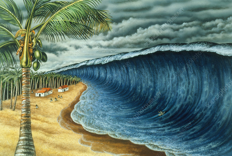
According to experts, tsunamis can be generated by significant water displacement in oceans or lakes. However, they are most often caused by the movement of tectonic plates at the bottom of the ocean, during a devastating earthquake.
However, tsunamis can also be triggered by volcanic eruptions, the impact of meteorites, or landslides. Based on articles written on australiangeographic.com.au, tsunamis often occur throughout the history of human civilization. But the country most often ‘approached’ in Japan.
The word tsunami is also said to originate from the language of the State of Sakura: ‘tsu’ means harbor, and ‘nami’ is a wave. “It was quite frightening to realize that this (Japanese tsunami) event was smaller in scale than the Indian Ocean tsunami that occurred in 2004, even smaller than the 1960 Chile tsunami.
But the death of the population and the damage it caused the Japanese economy to plummet, “said Director of the Australian Tsunami Research Center and Natural Hazards Research Lab at the University of New South Wales, Professor James Goff.
He added, “This is a tragedy caused by a truly unexpected event.”
Because there is little historical data on the size of the tsunami waves, scientists rank them according to the amount of damage caused by the tsunami. Here are 5 of them:
Lisboa, Portugal - November 1, 1755
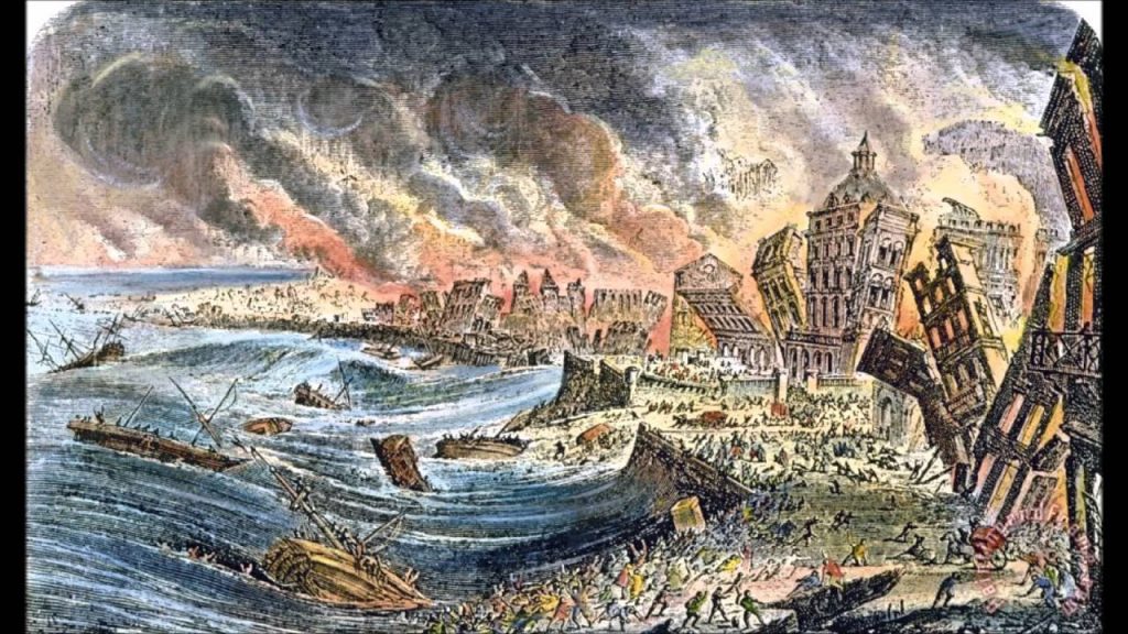
At 9.40 local time, an 8.5 magnitude earthquake shook Lisbon and the surrounding area - along the west coast of Portugal and southern Spain. Worse yet, the earthquake was followed by a tsunami and severe fires.
Geologists say the epicenter of the earthquake was in the Atlantic Ocean, about 200 km (120 miles) southwest of Cape St. Vincent. Total deaths were recorded between 60,000 and 100,000 people.
Reports at the time stated that the earthquake, which lasted between 3 and 6 minutes, caused a large fracture as wide as 5 meters to appear in the middle of the city. About 40 minutes after the earthquake, a massive tsunami hit the harbor and entered the city through the Tagus River. More than two waves followed the quake.
Whereas in areas not affected by tsunamis, large fires suddenly occur. The red rooster devoured the city for three days. Lisbon is not the only city in Portugal affected by the disaster. Along the southern part of the city, especially the Algarve, the damage is rampant. Sudden waves from the earthquake spread throughout Europe as far as Finland and North Africa.
A 20-meter high tsunami swept the coast of North Africa and hit Martinique and Barbados that crossed the Atlantic. A three-meter tsunami hit the coast of southern England.
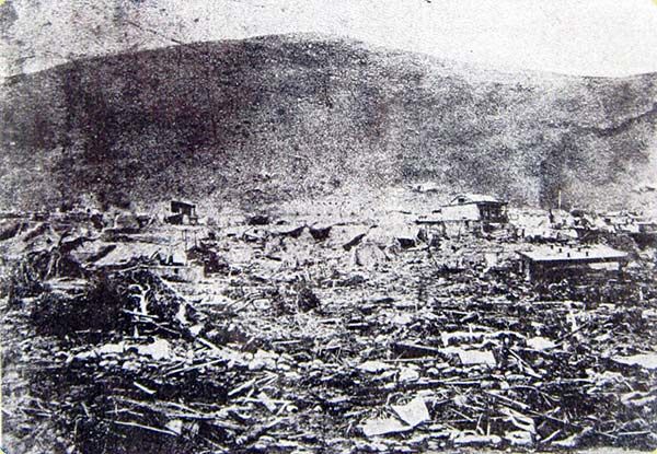
Krakatau, Indonesia - August 27, 1883
Suspicious things have been monitored from Krakatau for a long time. In May 1883, the captain of the German warship, Elizabeth, reported a burst of an ash cloud on the mountain located in the Sunda Strait. It reaches 9.6 kilometers high. And for two months later, commercial ships, as well as those deliberately chartered for tourism, watched Krakatoa up close, reporting the roar and glowing clouds.
Meanwhile, residents on the nearby island hold a kind of festival to celebrate the natural ‘fireworks’ that light up the night sky. They are not aware, and the danger is approaching. On Sunday, August 26, 1883, at 12:53 am, the initial eruption spewed clouds of gas mixed with volcanic material as high as 24 kilometers above Mount Perboewatan.
“Krakatau’s dying convulsions lasted 20 hours and 56 minutes,” Simon Winchester revealed in his Krakatoa book: The Day the World Exploded, August 27, 1883.
The climax is a devastating explosion that occurred on Monday, August 27, 1883, at 10:02 am. Four catastrophic explosions that occurred deafened people who were relatively close to Krakatoa. However, the roar was heard as far as Perth, Australia, which is 4,500 kilometers away. Its strength is equivalent to 200 megatons of TNT, more than 10,000 times the power of the atomic bomb that destroyed Hiroshima, Japan, at the end of World War II. Tephra and hot clouds claimed many lives in Java and western Sumatra.
However, the majority of fatalities, totaling 36 thousand, fell due to the tsunami. A 120-foot or 36.5-meter high wall of water appeared, triggered by the collapse of Krakatoa and the rise of the seabed. In the coastal area, the sound of thunder could be heard from a distance, his voice getting closer and stronger. The sea then goes crazy.
The tsunami struck mercilessly, the native-owned house of the thug, and the red-roofed building of the European people in Anyer was destroyed. Other coastal regions in Java and Sumatra have the same fate.
The explosion threw about 45 cubic kilometers of volcanic material into the atmosphere. Darken the sky that overshadows the area in a radius of 442 km from Krakatau. Barographs around the world document 7 shock waves.
Within 13 days, layers of sulfur dioxide and other gases began to filter out the amount of sunlight that could reach the Earth. Atmospheric effects caused by making spectacular sunset views throughout Europe and the United States. Global temperatures average 1.2 degrees colder over the next five years.
Forbes media said, the eruption of Krakatoa, in some aspects, is the first global disaster recorded in history. And, thanks to the discovery of modern communication tools (telegraph), reportedly soon spread throughout the world. After the eruption, Krakatoa was destroyed. Starting in 1927 or about 40 years after the eruption of Mount Krakatoa, volcanoes emerged known as Anak Krakatau.
Northern Chile - August 13, 1868
On August 13, 1868, at 21:30 local time, a series of two significant earthquakes - estimated at 8.5 to 9.0 SR - occurred off the coast of Arica, Peru (now Chile). Linda occurs along the border between the Nazca Plate and the South American Plate. The beaches of Peru and Chile have a history of large megathrust earthquakes originating from these plate boundaries.
The tsunami also appeared in the Pacific Ocean with a height of 21 meters. It was even reported to reach Hawaii, Japan, Australia, and New Zealand, which lasted between two and three days. This earthquake caused almost complete damage in southern Peru, including Arica, Tacna, Moquegua, Mollendo, Ilo, Iquique, Torta, and Arequipa, which caused around 25,000 deaths. In contrast, the damage caused by the earthquake and tsunami totaled around the US $ 300 million.
Sumatra, Indonesia - December 26, 2004
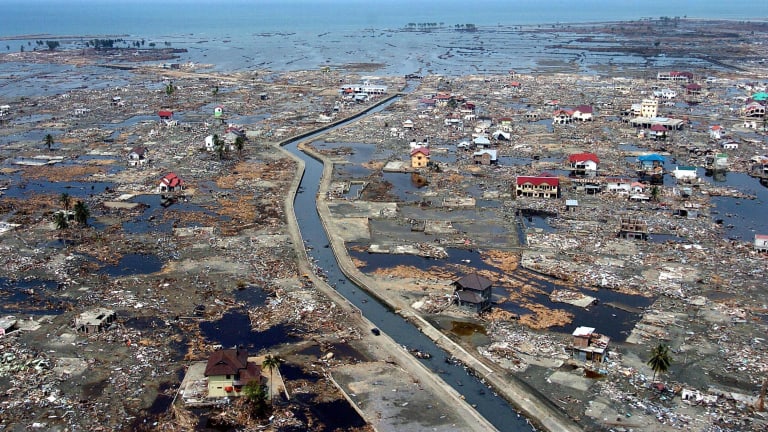
The 9.1 magnitude earthquake off the coast of Sumatra is estimated to have occurred at a depth of 30 km. The fault zone that caused the tsunami with a strike length of about 1,300 km vertically moved the seabed a few meters along the island. This is the third-largest earthquake ever recorded on a seismograph and the longest fault duration in history (between 8.3 and 10 minutes).
In addition, this earthquake also caused the entire Earth to vibrate 1 centimeter (0.4 inches) and triggered earthquake activity in various regions, including Alaska. The epicenter is located between Simeulue Island and Sumatra.
As a result of the magnitude quake, tsunamis as high as 15 to 30 meters appeared in various countries (while the maximum height was recorded at 51 m) in Lhoknga, Aceh. Tsunamis and earthquakes hit many countries in Southeast Asia and beyond, including Indonesia, India, Thailand, Somalia, Tanzania, Maldives, Sri Lanka, Kenya, South Africa, Myanmar, Bangladesh, the Maldives, Malaysia, the Seychelles and others.
Many eyewitnesses around the world reported an increase in sea wave height, including places in the United States, Britain, and Antarctica. The tsunami killed 230,000 to 280,000 people in 14 countries and sank many coastal settlements. This earthquake and tsunami were one of the deadliest natural disasters in history, and Indonesia became the most severely affected country, besides Sri Lanka, India, and Thailand. Total damage reached US $ 19.6 billion (the dollar exchange rate in 2017).
North Pacific Coast, Japan - March 11, 2011
On March 11, 2011, at around 14.46 local time, a devastating 9.0 magnitude earthquake shook the Tohoku region off the coast of the Pacific Ocean, specifically the eastern region of Sendai, Honshu, Japan.
The Tsunami Warning Center immediately issues tsunami alert in Japan and surrounding areas. This earthquake caused tsunami warnings for Japan’s Pacific coast and at least 20 countries, including the entire Pacific American coast from Alaska to Chile.
About an hour later, a tsunami as high as 33 feet or about 10 meters and traveling at 800 km per hour, hit the coastal areas of Miyagi Prefecture and its surroundings. As a result, around 18,000 human lives were lost.
Not only that, the next day, an earthquake measuring 6.2 on the Richter scale then shook Nagano and Niigata Prefectures. Lindu also rocked the west coast of Honshu Island with a strength of 6.3 SR. The Japan Broadcasting System (Tokyo Broadcasting System / TBS) and the Japanese National Police Agency reported a total death toll of 15,269 people, 5,363 injuries, and 8,526 missing in six Sakura prefectures.
The shock also resulted in a nuclear emergency, where the Fukushima Daiichi nuclear power plant began to leak radioactive steam. The World Bank estimates that it can take up to five years for Japan to overcome financial losses of US $ 235 billion.
Donations